I’ve Explored 7 Walkabale Cities Around The World + 9 Where I Definitely Needed A Car

As someone who lives to explore new places, I’ve learned that not all cities are created equal when it comes to getting around. Some destinations invite you to wander their streets, stumble upon hidden cafes, and soak up the local vibe on foot.
Others? They practically beg for a set of wheels just to get from point A to B. Based on my own travel experiences, here’s where walking unlocked the heart of the city — and where I was grateful to have a car key in hand.
1. Venice, Italy
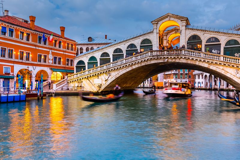
Cars simply don’t exist in this romantic network of islands! The labyrinth of narrow alleys and tiny footbridges makes Venice uniquely walkable.
Exploring this Italian gem means navigating 400+ bridges connecting 118 small islands. Water taxis and gondolas replace traditional vehicles, creating a pedestrian utopia where getting lost is half the fun.
2. Amsterdam, Netherlands
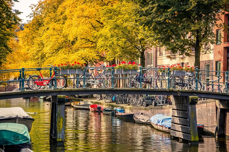
Compact city planning makes strolling between attractions a breeze. The picturesque canal belt provides perfect walking routes that showcase the city’s charm.
Amsterdam’s historic center spans just 8 square miles. The Dutch capital features over 1,200 bridges and 60+ miles of canals, creating a pedestrian-friendly environment where most residents don’t own cars and visitors can explore entirely on foot.
3. Boston, USA
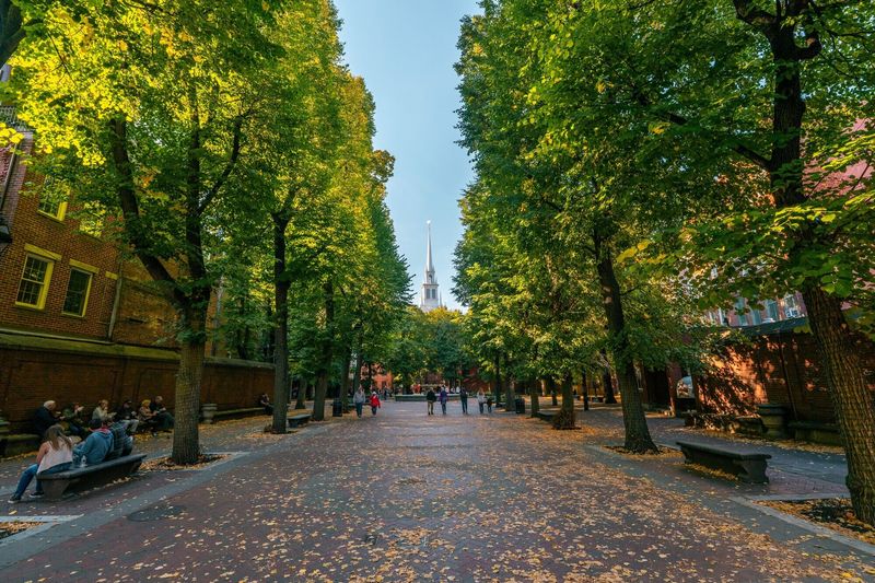
Following the famous Freedom Trail reveals centuries of American history in just 2.5 miles. The compact downtown area packs countless attractions within easy walking distance.
Boston earned its nickname honestly. Unlike many sprawling American cities, its historic core developed before automobiles. Narrow, winding streets based on old cow paths and colonial-era planning create an intimate, European-like atmosphere perfect for pedestrian exploration.
4. Paris, France

Grand avenues connect major landmarks in surprisingly walkable distances. The Seine’s pedestrian-friendly banks offer breathtaking perspectives of the city’s iconic architecture.
Paris was redesigned in the 19th century with wide boulevards perfect for promenading. The French capital’s 20 arrondissements create a spiral of neighborhoods, each with distinct character, connected by 37 bridges spanning the river that divides yet unites the city.
5. Florence, Italy

Medieval streets create an intimate atmosphere where world-class museums and cathedrals sit minutes apart. The historic center feels like an open-air museum you can traverse entirely on foot.
Florence’s compact historical core spans just one square mile. The Arno River cuts through this Tuscan gem where Michelangelo and da Vinci once walked. Most major attractions cluster around the magnificent Duomo, making it perfect for pedestrian exploration.
6. Kyoto, Japan

Wandering through historic districts feels like stepping back in time. The efficient public transportation perfectly complements foot travel between temple sites.
Kyoto’s grid-like street pattern dates back to the 8th century. Traditional wooden machiya houses line pedestrian-friendly streets, especially in Gion where geisha still hurry along narrow lanes preserved from Japan’s imperial past.
7. Singapore
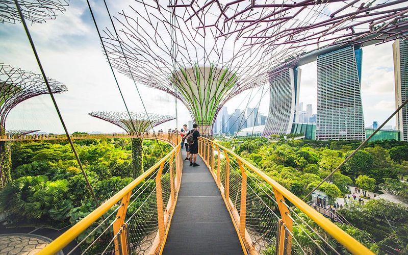
Tropical heat doesn’t deter walking thanks to brilliant urban planning. An extensive network of air-conditioned underpasses and elevated walkways connects shopping districts, transit hubs, and attractions.
Singapore’s innovative pedestrian infrastructure spans 15+ miles. The city-state’s commitment to becoming a “garden city” means lush greenery lines walkways while the efficient MRT system complements foot travel, making car ownership unnecessary for most residents.
8. Los Angeles, USA
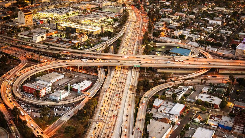
Attempting to navigate without wheels quickly reveals why locals joke that “nobody walks in LA.” The vast metropolitan area stretches across 500+ square miles of disconnected neighborhoods.
Los Angeles developed around automobile transportation in the mid-20th century. Freeways replaced planned public transit, creating a city where attractions might be 40+ miles apart. Limited sidewalks in many areas make pedestrian travel not just inconvenient but often dangerous.
9. Dubai, UAE
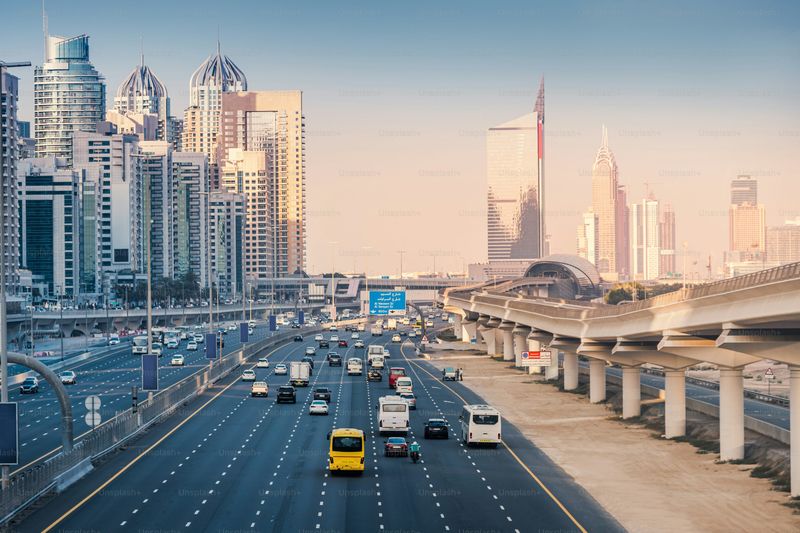
Summer temperatures reaching 120°F make outdoor walking nearly impossible for half the year. The city’s ambitious scale features 12-lane highways connecting distant artificial islands and indoor attractions.
Dubai’s rapid development prioritized spectacular architectural statements over pedestrian concerns. Shopping malls become necessary refuges from the heat rather than just retail destinations. Without a vehicle, experiencing this Middle Eastern marvel becomes an expensive exercise in taxi logistics.
10. Houston, Texas

Attempting to cross eight-lane roads between strip malls quickly taught me why locals drive everywhere. The lack of zoning laws created a patchwork metropolis where walking feels like an afterthought.
Houston spans nearly 640 square miles of low-density development. The Texas city’s famous lack of zoning regulations means residential areas suddenly transition to industrial zones without warning. Summer humidity combines with minimal shade to make pedestrian travel uncomfortably challenging.
11. Cape Town, South Africa
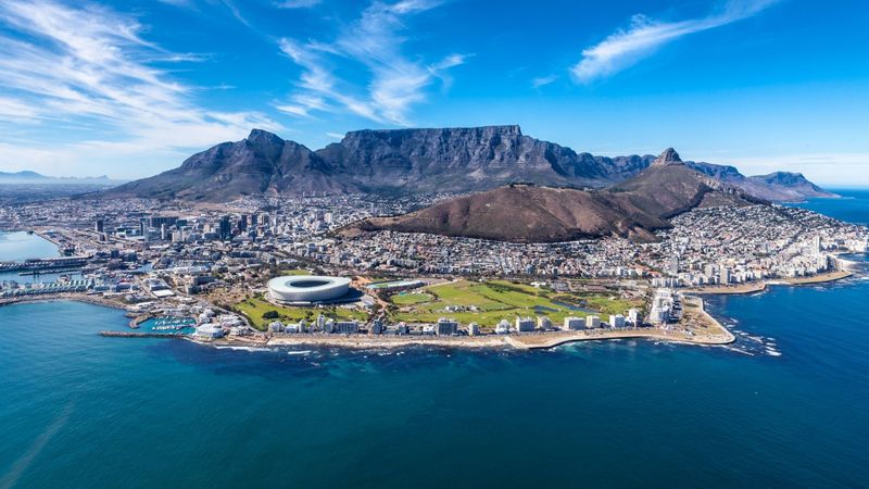
Stunning coastal scenery comes with challenging logistics for car-free travelers. The city spreads between mountains and ocean, creating distinct areas separated by significant distances.
Cape Town’s dramatic topography creates natural barriers between neighborhoods. Table Mountain divides the city center from southern suburbs, while security concerns in certain areas make walking inadvisable. The spectacular coastline and wine regions surrounding the city are virtually inaccessible without private transportation.
12. Phoenix, Arizona
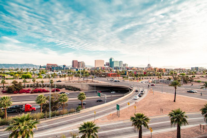
Summer sidewalk temperatures can literally melt shoe soles! The metropolitan area covers a staggering 14,600 square miles, making pedestrian travel between destinations practically impossible.
Phoenix emerged as a car-centric city during America’s post-war suburban boom. The grid system creates deceptively long blocks that appear walkable on maps but prove challenging in reality. Shade is precious in this desert metropolis where summer temperatures regularly exceed 110°F.
13. Sydney, Australia
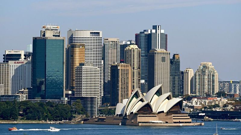
Ferries provide iconic harbor views but can’t replace comprehensive transportation. The sprawling metropolitan area spans over 4,700 square miles with suburbs stretching far from the famous opera house.
Sydney’s geographical challenges include numerous bays and inlets creating natural barriers. While the central business district offers walkable attractions, experiencing the city’s diverse neighborhoods and famous beaches requires motorized transportation. The Blue Mountains and wine regions lie hours from downtown.
14. Johannesburg, South Africa
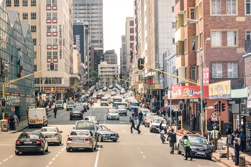
Security concerns make walking between districts inadvisable in many areas. The city developed as a collection of mining camps without centralized planning, creating disconnected neighborhoods requiring vehicular transportation.
Johannesburg sprawls across 635 square miles of high-elevation plateau. Founded as a gold mining settlement in 1886, the city grew haphazardly around wealth extraction rather than human-scale design. Massive highways now connect distinct commercial centers and gated communities.
15. Mexico City, Mexico
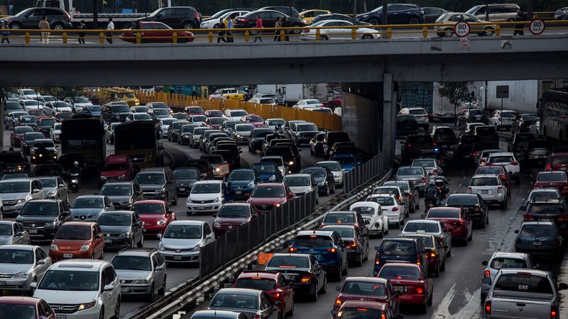
The historic core offers walkable plazas and museums, but the metropolitan area extends an astonishing 60+ miles across. Attempting to navigate between distant neighborhoods without wheels quickly becomes a logistical nightmare.
Mexico City’s population exceeds 21 million across 573 square miles. Built atop the ancient Aztec capital of Tenochtitlan, the central historic district maintains a pedestrian-friendly layout. However, most residents live in vast suburban areas where car ownership or lengthy public transit commutes are unavoidable.
16. Sao Paulo, Brazil
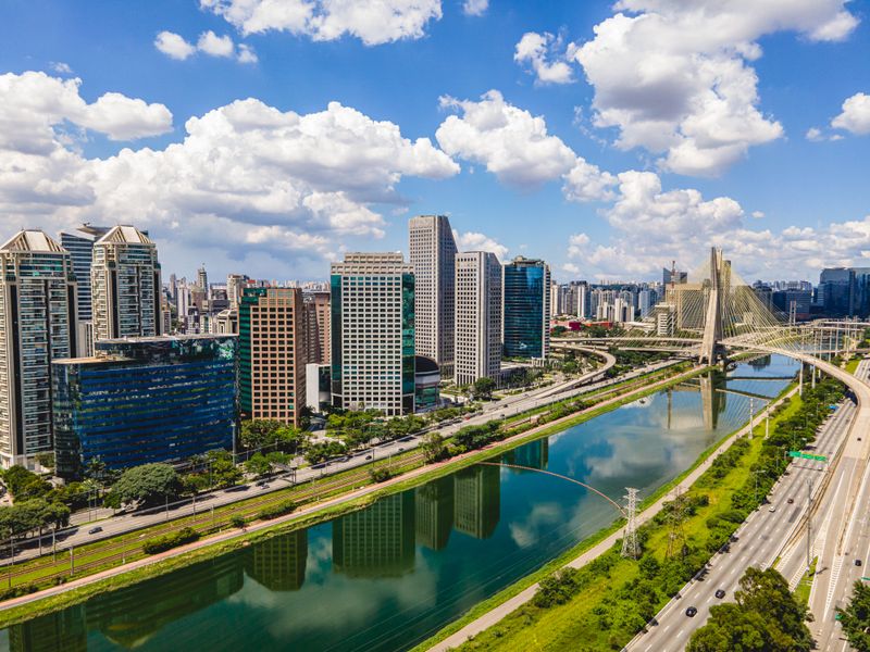
South America’s largest city overwhelms with its sheer scale. The metropolitan region houses over 22 million people across 3,000 square miles of high-rise neighborhoods and industrial zones.
Sao Paulo’s famous traffic jams can stretch 100+ miles during peak hours. The Brazilian megacity grew rapidly during 20th-century industrialization without comprehensive planning. Helicopter travel became so common among wealthy residents that the city now features the world’s largest fleet of private choppers.